
Phase II
Our second online questionnaire-based study was again administered to geospatial data users and producers. The questionnaire comprised six sections, A to F:
•Section A consisted of a small number of questions to gather background information about the respondents and their requirements when selecting geospatial data to use;
• Section B was designed to explore respondents’ levels of understanding of the proposed GEO label facets (informational elements) and the information the facets convey about the datasets they represent;
• Section C was focused on gauging respondents’ opinions of the effectiveness of the proposed GEO label prototypes – that is, the complete labels rather than the component parts (as studied up until this point) – at conveying availability of dataset quality information;
• Section D consisted of a small number of questions to gather respondents’ opinions on the informational aspects presented in the GEO label examples;
• Section E consisted of a small number of questions designed to gather respondents’ opinions on the use of ‘GEO’ branding in the GEO label; and
• in Section F, the respondents were asked to provide any further comments and suggestions on the GEO label and the proposed GEO label designs
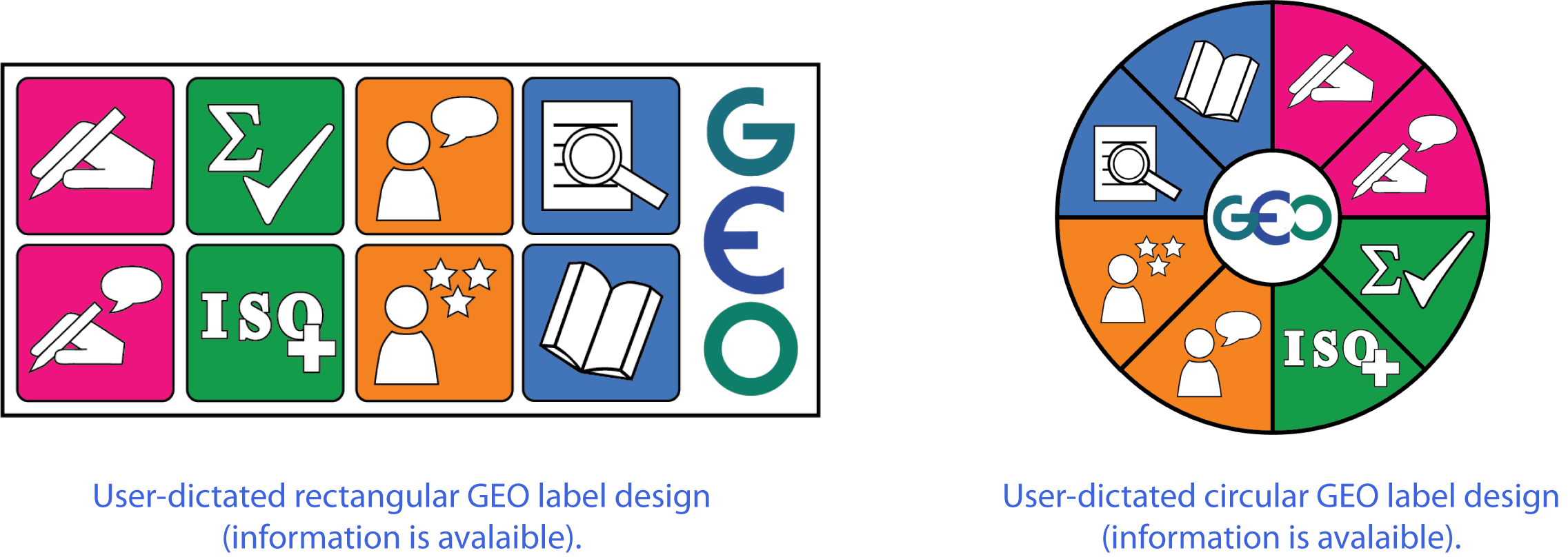
Overall, the study results indicated that, unfortunately, none of the proposed GEO label visualisations were as yet sufficiently effective to stand as the final GEO label design. Nevertheless, respondents’ feedback has provided rich information on which basis to identify essential GEO label design modifications and improvements and derive final GEO label requirements. The findings of this study led us to conclude that the final user-dictated graphical GEO label representation should either be a hybrid of two of the tested prototype designs (the circular and star-based designs) or should adopt a modified version of the rectangular design, comprising the 8 informational aspects but solely conveying information availability:
a) dataset producer information;
b) producer comments on the dataset quality;
c) dataset’s compliance with standards;
d) user feedback;
e) user ratings of the dataset;
f) expert reviews;
g) dataset citations; and
h) dataset quality information.
Consequently, we developed updated user-dictated proposals for the GEO label representation. It is important to note at this point that these visualisations have not yet been validated; their evaluation is being carried out as part of Phase III of our research.