

Phase I
In order to conduct an initial investigation into both geospatial data producers’ and users’ views on the concept of a GEO label and the role it should serve, we conducted an online questionnaire-based survey. Our questionnaire comprised five parts, A to E:
• the user-oriented version of Section A focused on eliciting information about the degree to which users have a choice of dataset to use and what typically impacts or influences this choice;
• the data producer-oriented version of Section A was naturally focused on the production rather than selection of datasets;
• Section B comprised a small number of questions to gather information about users’ and producers’ initial views on the role that a GEO label should serve;
• Section C focused on gauging respondents’ awareness and opinion of commonplace e-Commerce rating systems and certification programmes;
• Section D was designed to explore respondents’ reaction to the concept of a GEO label that is clickable and supports a drill-down function; and
• in Section E, we asked respondents to indicate and explain their preferences for the role of a GEO label.
We received a total of 87 valid questionnaire responses: 57 from self-identified dataset users and 30 from self-identified dataset producers. The questionnaire was accessed and completed from a number of countries including Austria, Spain, Germany, Slovenia, Greece, United States, Netherlands, France, Italy, United Kingdom, Belgium, Switzerland, China, Bolivia, and Estonia – suggesting that we have successfully solicited opinions of experts from a variety of user groups and cultures around the world.
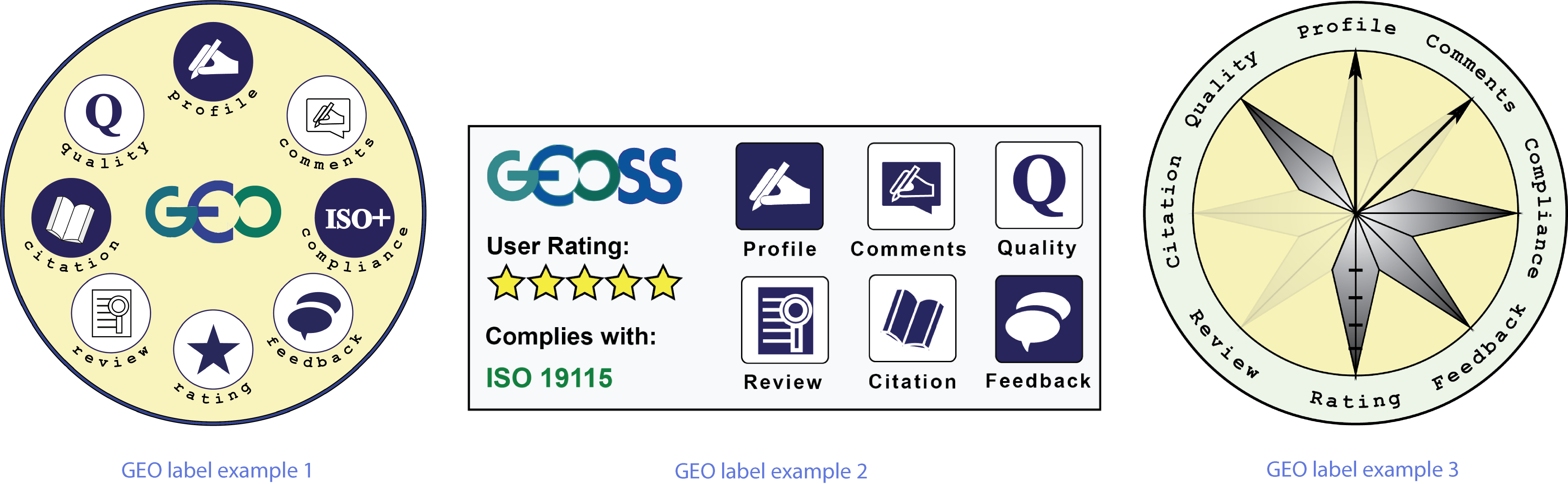
Overall, the results of our study show that users and producers of geospatial datasets appear to have generally very positive attitudes towards the development and introduction of a GEO label. The majority of users and producers most strongly supported the notion of a GEO label providing an all-in-one drill-down interrogation facility that would combine expert value judgements, community advice, links to citation information, side-by-side visualisation of metadata records, etc. This suggests that, in order to make an informed dataset selection decision, respondents require and would appreciate as much information as possible presented in one place in a format that allows for easy comparison. Based on our findings, we developed three GEO label examples. These were prototypic graphic representations (i.e., static images) which could potentially be used to convey availability of spatial dataset quality information. These GEO label visualisations combine our 8 identified and confirmed informational aspects:
a) dataset producer information;
b) producer comments on the dataset quality;
c) dataset’s compliance with standards;
d) user feedback;
e) user ratings of the dataset;
f) expert reviews;
g) dataset citations; and
h) quantitative dataset quality information.
To evaluate the comparative effectiveness of, and user preference for, the three prototype visualisations, we conducted a third user study, also administered as an online questionnaire.